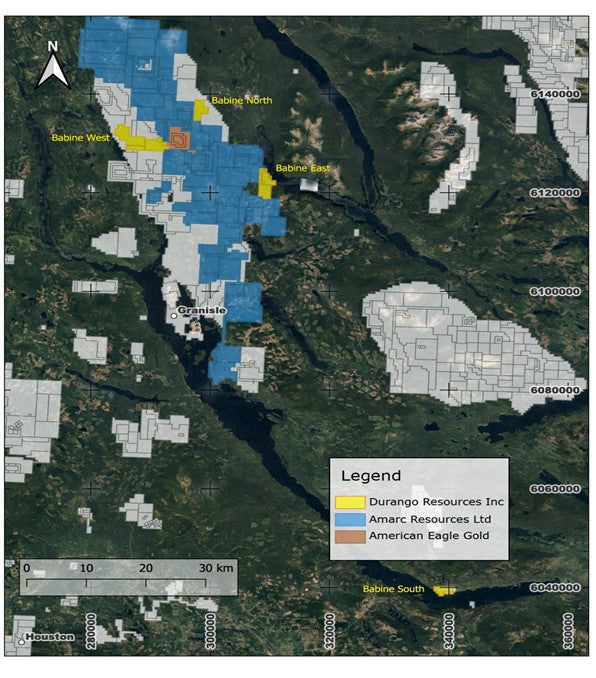
Regional Significance
Situated approximately 80 kilometers north of Smithers, the Babine Region stands as one of British Columbia’s most prolific porphyry copper-gold belts. It hosts notable past-producing mines such as the Bell and Granisle, as well as significant deposits like the Morrison copper-gold deposit. The area benefits from well established infrastructure, including all season roads, Highway 16, and railway access, facilitating efficient exploration and potential development activities. (Quantum Critical Metals is previous Durango Resources on map).

2,303 hectares
Babine West
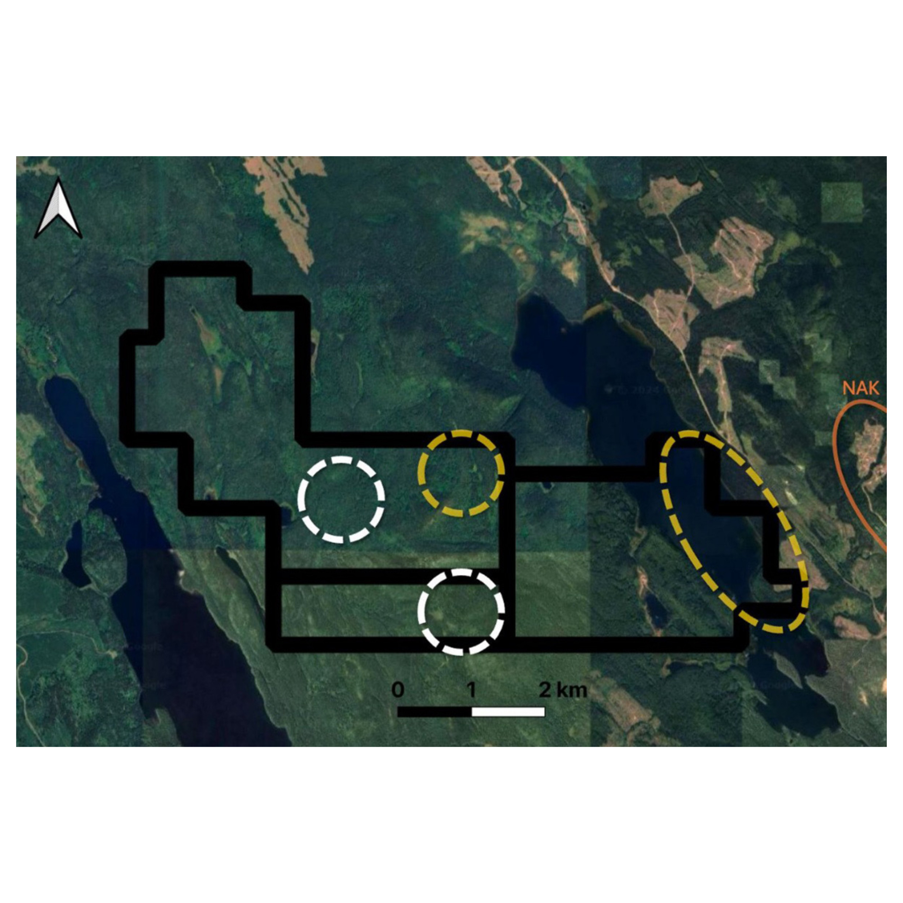
- Location: Borders the west side of American Eagle’s NAK property (TSXV-AE) and Amarc Resources’ Duke Property (TSXV-AHR).
- Geology: Characterized by a granodiorite stock with phases of quartz monzonite and hornblende biotite feldspar porphyry of the Eocene Babine Intrusion, intersecting grey, locally graphitic siltstones of the Middle to Upper Jurassic Ashman Formation. Notably, pyrite has been identified in six outcrops and chalcopyrite in one, indicating potential mineralization.
- The Babine Copper-Gold Project’s proximity to significant discoveries, such as American Eagle’s NAK project and Amarc Resources’ Duke project, enhances its strategic value.
- Notably, American Eagle reported a drill hole (23-17) returning 302 meters at 1.09% CuEq on the western portion of the NAK property, located less than 2 kilometers from the eastern border of Durango’s Babine West Property.
717 Hectares
Babine North
- Location: Covers the historic Friday Red copper Minfile showing, located 90 kilometers east of Hazelton.
- Geology: Comprises gently dipping volcanic rocks and minor interbedded mudstones of the Lower Jurassic Telkwa Formation, intruded by a highly magnetic feldspar porphyry dike, possibly related to the Eocene Babine Plutonic Suite. Minor amounts of chalcopyrite are disseminated in the matrix of amygdaloidal volcanic units at the showing.
1,144 hectares
Babine East
- Location: Situated along the west side of the northwest arm of Takla Lake, encompassing the historic Minfile Adda showing.
- Geology: Underlain by volcanics and minor sediments. Historical observations include veins of chalcopyrite measuring 5-7.6 cm in width and narrow chalcopyrite seams in andesite just above the lakeshore, with assays reporting 5.49 g/t silver and 10.6% copper with trace gold.
1,070 hectares
Babine South
- Location: Covers the historic Minfile Bol showing on the north side of Babine Lake.
- Geology: The area is underlain by Cache Creek Group greenstone, with mineralization occurring in quartz carbonate veins and shears within foliated greenstone. Mineralization consists of argentiferous galena, sphalerite, tetrahedrite, argentite, chalcopyrite, native silver, pyrrhotite, and pyrite. Historical sampling reported significant silver values, including a sample yielding 2,790 grams per tonne silver.
Babine West Ai Study
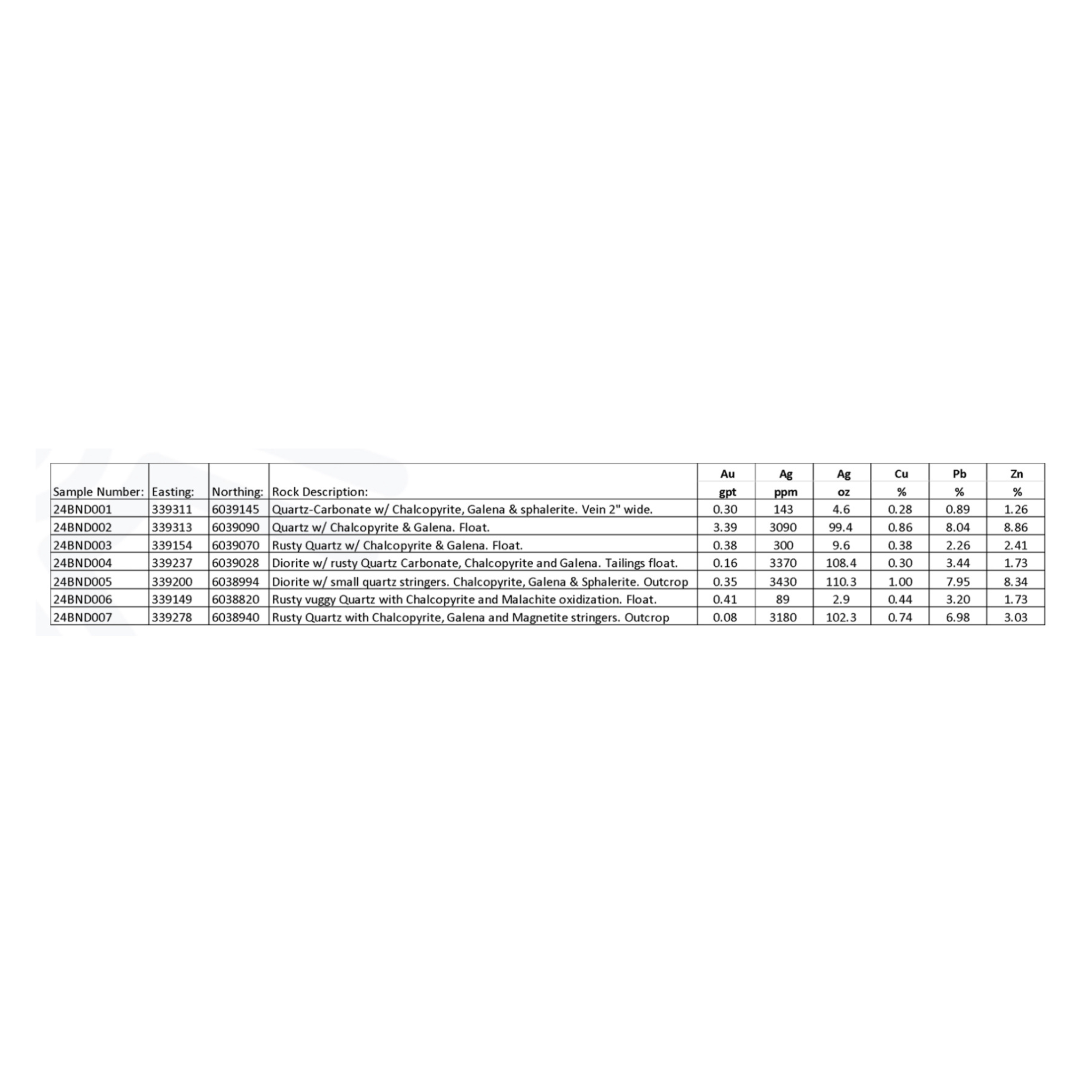
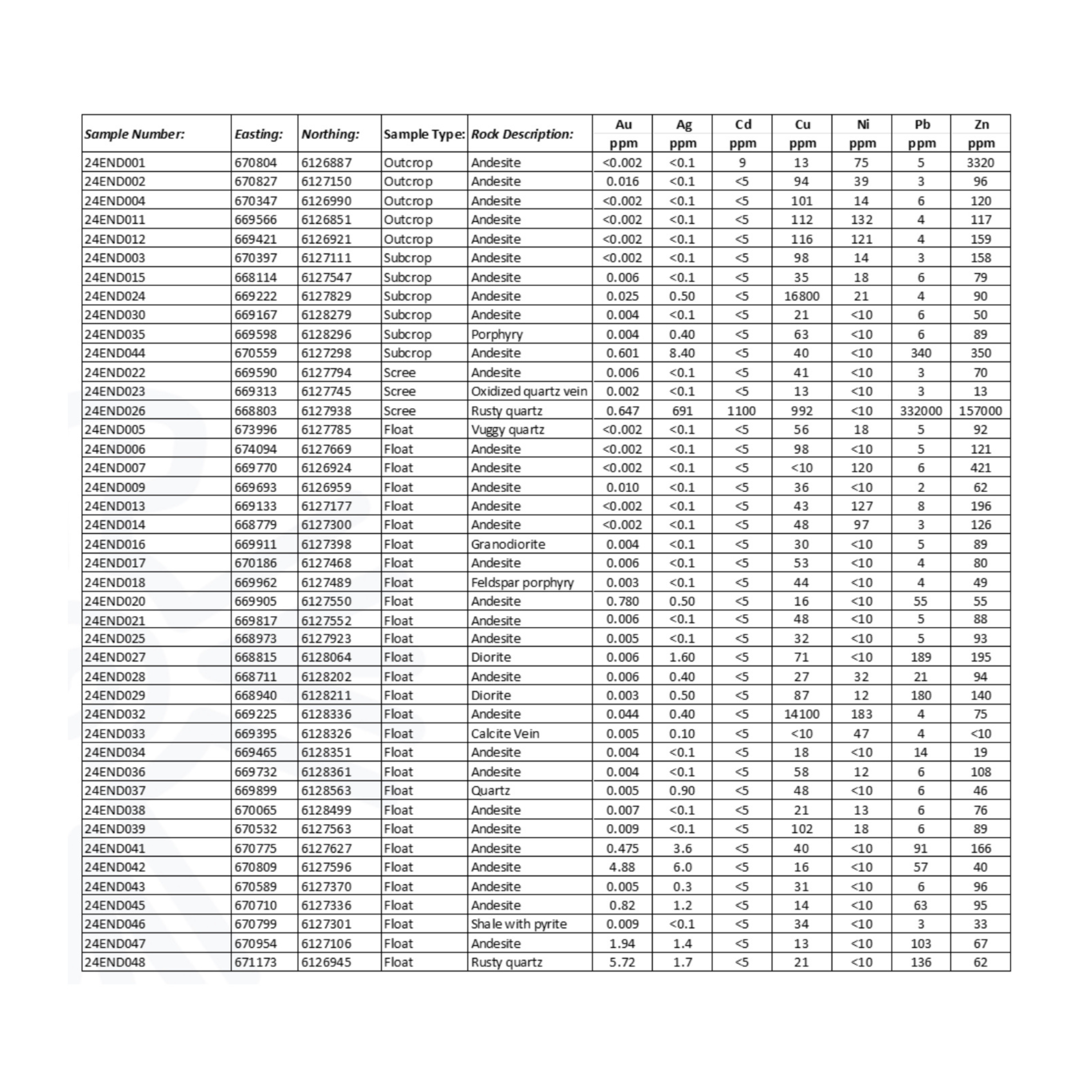
Babine West Sample Results
Babine West Sampling Map

Babine West Sample Results
Babine South Sample Results
Babine South Sample Map

Babine South Sample Results